
Stage 10 Route Map. A map showing the 65.0 mile route of Stage 10 along the Skyline Drive starting near Elkton, VA and Harrisonburg, VA and ending at the northern terminus of the Skyline Drive near Front Royal, VA. Click here to view Stage 10 in Google Maps.
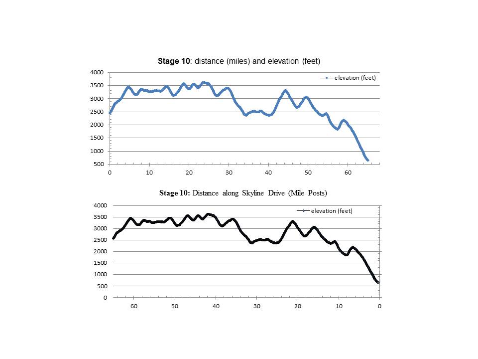
Stage 10 Elevation Profile Graphs. The upper graph shows distance ridden (miles) and elevation climbed (feet). The lower graph shows distance ridden (Skyline Drive Mile Posts) and elevation climbed (feet).
