
Stage 2 Route Map. A map showing the 58.3 mile route of Stage 2 along the Blue Ridge Parkway starting south of Asheville, NC. And ending near Micaville, NC. This stage includes the climb up Mt. Mitchell (6,584 ft), the highest peak in the eastern US. Click here to view Stage 2 in Google Maps.
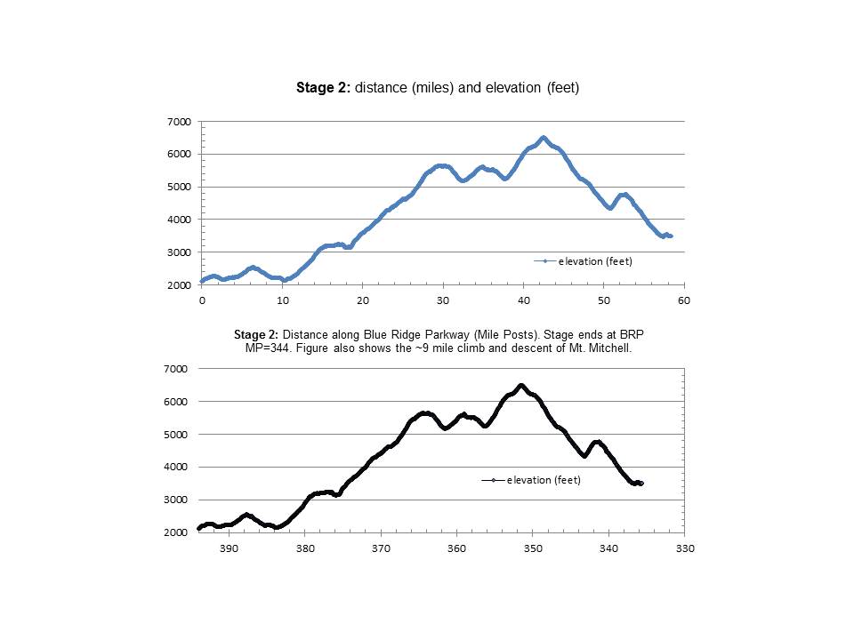
Stage 2 Elevation Profile Graphs. The upper graph shows distance ridden (miles) and elevation climbed (feet). The lower graph shows distance ridden (Blue Ridge Parkway Mile Posts) and elevation climbed (feet). This stage includes the climb up Mt. Mitchell (6,584 ft), the highest peak in the eastern US.
