
Stage 8 Route Map. A map showing the 63.7 mile route of Stage 8 along the Blue Ridge Parkway starting at the James River Bridge and ending at the northern terminus of the Blue Ridge Parkway near Waynesboro and Charlottesville, VA. Click here to view Stage 8 in Google Maps.
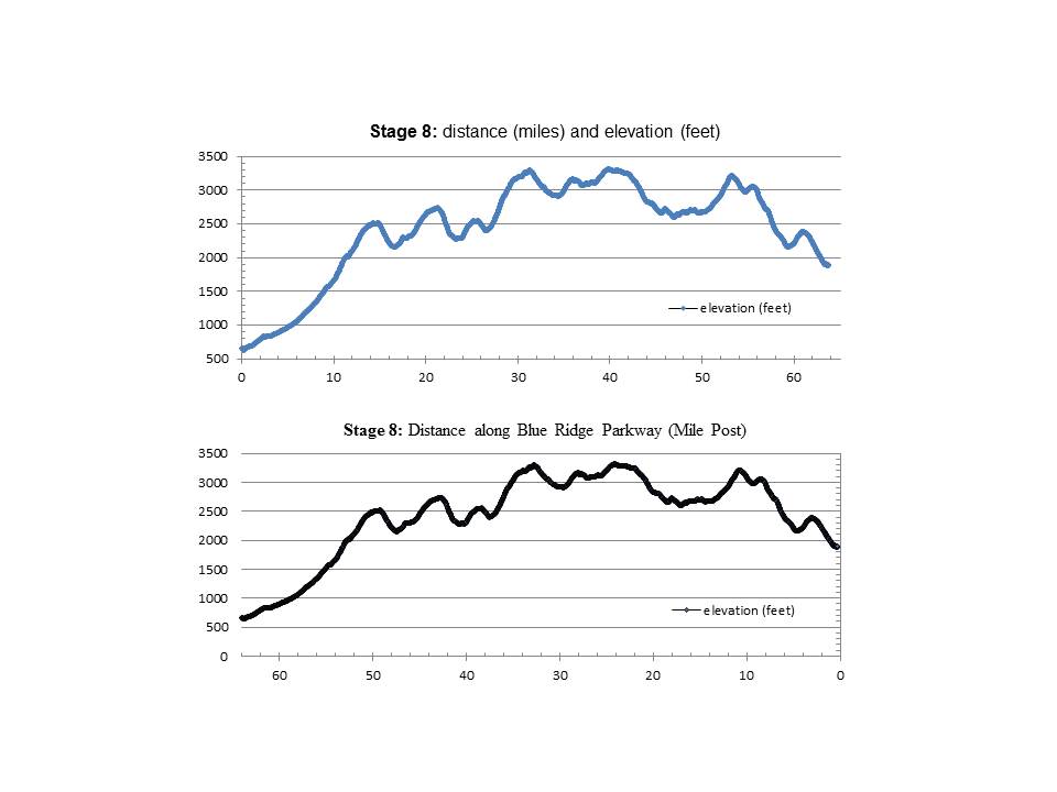
Stage 8 Elevation Profile Graphs. The upper graph shows distance ridden (miles) and elevation climbed (feet). The lower graph shows distance ridden (Blue Ridge Parkway Mile Posts) and elevation climbed (feet).
